The right technology in the right hands: bridging the gap between data and impact
Michael Jurua may have graduated only a few years ago, but he’s already making a significant impact in geospatial conservation—earning recognition both in Uganda and internationally.
A driving force for youth-led action, combining Earth observation technology with local knowledge, Michael embodies his belief that “when technology is placed in the hands of local communities and young Africans, it can fundamentally transform how we protect the natural world.”
The inspiration
When discussing his inspirations, Michael highlights two early experiences: growing up in rural Western Uganda and an early introduction to the Roots & Shoots program — a global initiative by the Jane Goodall Institute (JGI) that aims to empower young people to create positive change for their environment and community.
“Growing up I spent much of my childhood on the edges of forests that were a livelihood for my community. One dry season, when I was a teenager, a wildfire swept through farmland near our village. I watched families scramble to protect their crops, carrying water in jerricans while smoke blotted out the sun. Nobody had been warned. The fire had started kilometres away and moved faster than word could travel.
“What struck me most was not the fire itself, but the silence that preceded it. There were no systems in place, no alerts, no coordination, just people reacting after damage had been done. Forests that local families depended on for fuel, medicinal plants and clean water were scorched within hours.”
The question “What if communities could be forewarned?” has been central to Michael’s work since.
“But the seed was planted even earlier, when I joined the Jane Goodall Institute’s Roots & Shoots program in third grade. What the program gave me at that age was something quite specific: the understanding that young people could act, not just observe — that young people can be active agents of change in their own communities, not just bystanders.”
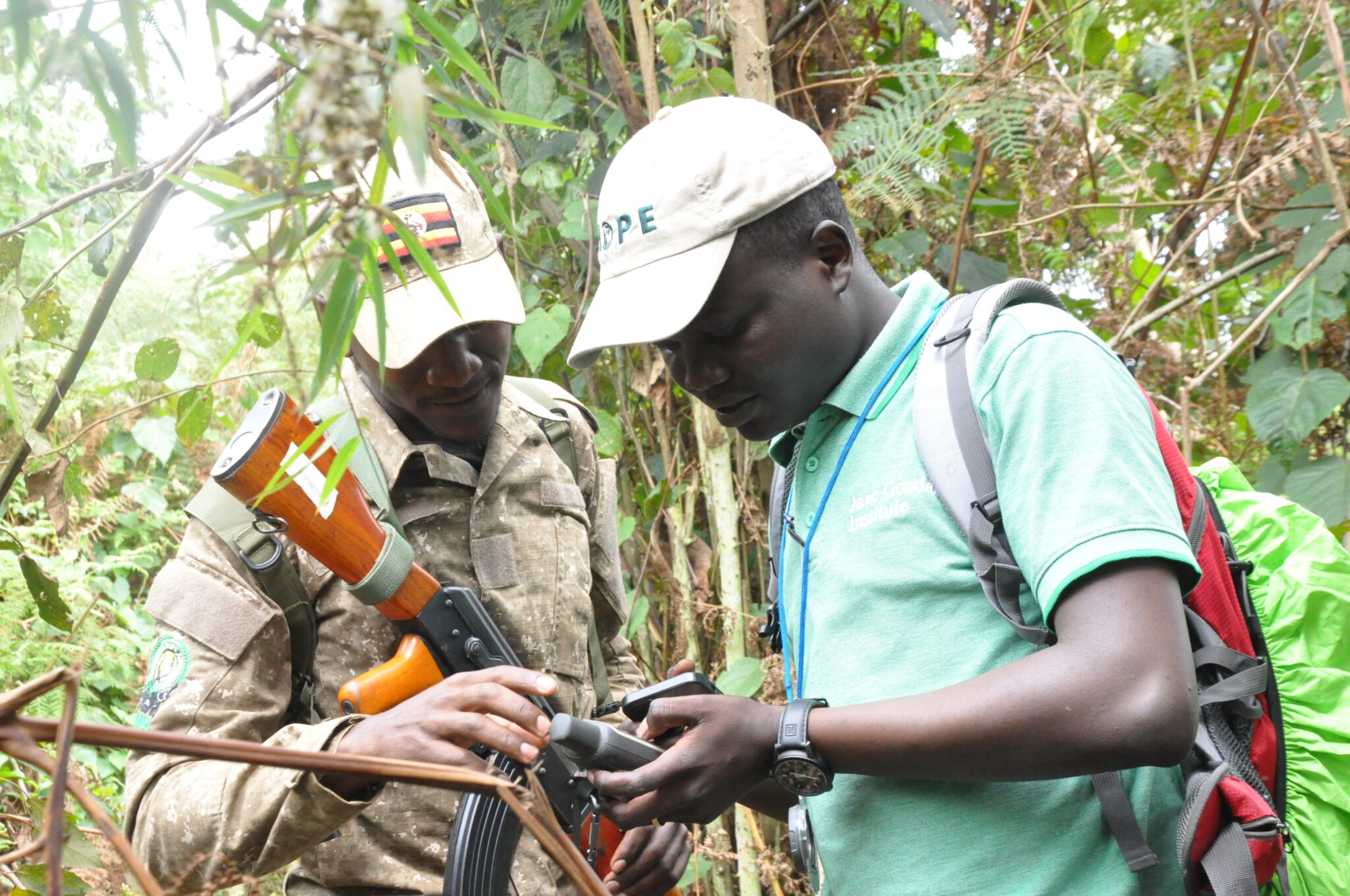
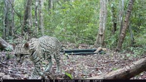
Conducting the first ever chimpanzee census in the Bwindi Impenetrable National park, a UNESCO World Heritage site and transboundary habitat – Credit: Michael Jurua
The focus
These beliefs took root and grew over the years, and when Michael arrived at university, he discovered geospatial science — the science and technology behind the precise, digital mapping of the Earth. He remembers being drawn to understanding place and environment through data, while not fully knowing where it would lead.
“Studying geomatics, I discovered satellite remote sensing and realised that the answer already existed in the data. Satellites were detecting heat signatures and vegetation stress across entire landscapes in near real time. The technology was there; the gap was translating that data into actionable alerts that reached the right people fast enough to matter.
“That realisation became the foundation of FireLens, the early-warning wildfire intelligence system I have spent the last few years building and piloting. Every alert the system sends, every fire contained before it spreads, connects back to that afternoon in my village.”
Michael’s motivation and conviction are clear:
“I see the world as a place where the right information, delivered to the right person at the right moment, can change outcomes. That belief drives my work.”
Joining JGI Uganda in a working capacity after graduation was another pivotal step:
“It gave me the institutional context, community networks and real conservation challenges needed to take technical skills and build something with genuine impact. Learning to communicate that work — writing, presenting at international forums and engaging with local communities in the field — has been as important as any technical skill I’ve learned.
“It also felt, in many ways, like coming home, returning to the organisation that had first shown me what it meant to be an agent of change.”
His current role
As Conservation Science and MEL (Monitoring, Evaluation and Learning) Manager at JGI Uganda, Michael’s work sits at the intersection of Earth observation technology and community-led conservation, and the scope, he says, is broader than people might expect.
“On the technical side, I lead the development of geospatial monitoring systems used to track deforestation, wildfire risks and ecosystem restoration. This involves processing satellite imagery, building predictive models and giving conservation authorities a near real-time picture of what’s happening on the ground.
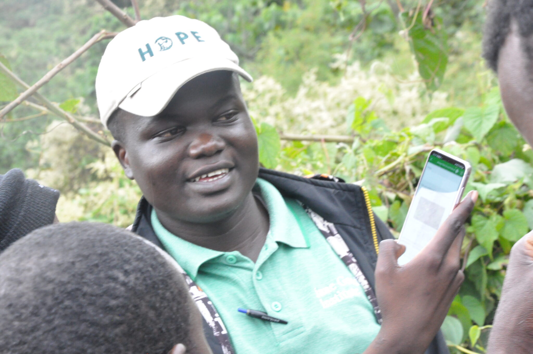
“On the community side, I supervise a network of over 500 community forest monitors. These are local people, not scientists, who’ve been trained and equipped to become the eyes and ears of our monitoring system in the field. That integration of satellite intelligence with human presence on the ground is what makes our approach distinctive.”
Michael also leads JGI’s monitoring and evaluation systems, produces analysis for grant proposals and donor reports, and increasingly represents the organisation at international platforms — from UNCCD COP16 in Riyadh to the GEO Global Forum in Rome.
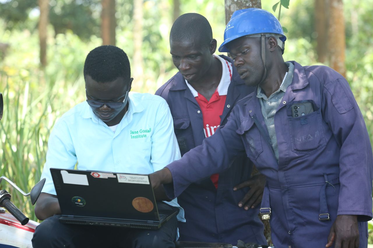
Monitoring threats and illegal activities within the highly endemic Albertine rift region of Uganda together with JGI Forest Monitors – Credit: Michael Jurua
The highlights
For Michael, the best part is when data produces a real, measurable outcome on the ground:
“Using Polarimetric SAR Interferometry during my undergraduate research, I identified a 3.7% annual deforestation rate in the Budongo Tropical Rainforest, findings precise enough to directly inform conservation interventions by the National Forestry Authority.
“More recently, leading the first-ever scientific census of chimpanzees in Bwindi Impenetrable National Park, a UNESCO World Heritage Site, was one of the most meaningful experiences of my career. Establishing the first reliable population estimate of 426 individuals provides a crucial baseline for long-term conservation planning and protection.”
Michael proudly acknowledges that this kind of foundational data will matter for decades. But he’s equally enthusiastic about human development:
“I love watching a community forest monitor, who may never have used a GPS device before joining our program, confidently collecting and transmitting field data that feeds into a national conservation decision. Technology becomes a tool for empowerment, not just analysis. That combination is what keeps me energized.”
This difference that Michael’s making has led to both local and international accolades — although he emphasises that their real importance lies in what they represent:
“The UNDP Youth4Climate Award of USD 30,000, the GEO Emerging Leader Award as the youngest and only African awardee in 2025, the Government of Uganda’s Wildlife Digital Innovations Award, and being named among Geospatial World’s 50 Rising Stars in 2026 matter to me largely because they signal that African-led innovation in this field is being seen globally. That representation is important for the next generation of young scientists on this continent.”
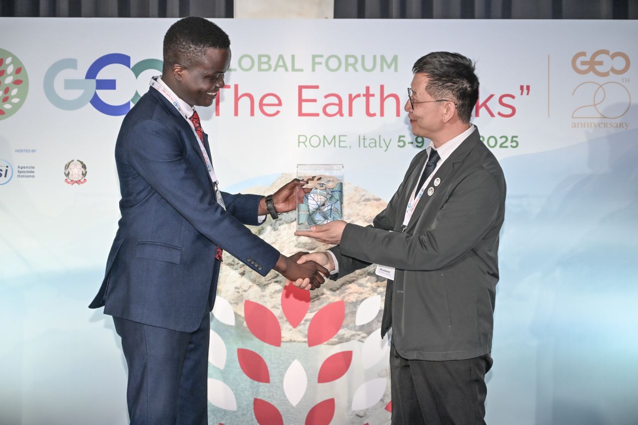
Receiving the Group on Earth Observations (GEO) Emerging Leader Award as the youngest and only African awardee in 2025 – Credit: Michael Jurua
The challenges
Michael stresses that the hardest part is the gap between what the data shows and what can actually be done about it:
“We can detect deforestation in the Budongo Tropical Rainforest with enough precision to identify specific rates of loss and pinpoint where it’s happening. We can map ecosystem threats across multiple protected landscapes simultaneously. But translating that intelligence into sustained, funded, coordinated action takes time — and ecosystems don’t wait.
“Working in a resource-constrained environment also means constantly making difficult trade-offs, as budgets and capacity are always limited. You learn to prioritise ruthlessly and be creative about partnerships.”
He acknowledges that there are moments when the scale of the environmental challenges — happening simultaneously — can feel genuinely overwhelming. But he adds that what keeps him grounded is focusing on what is within reach: the forest that’s still standing, the community that’s been equipped, the young mapper who now has lifelong skills.
Michael’s advice for young conservationists
- Start with free tools and start now. The open-source geospatial ecosystem — QGIS, Python, Google Earth Engine, Digital Earth Africa — has levelled the playing field enormously for young people in the Global South. I built the foundations of my career on these tools. You do not need expensive software or institutional access to begin doing meaningful work.
- As an undergraduate, I threw myself into every opportunity available: volunteering at the Budongo Conservation Field Station, joining YouthMappers, leading a multi-university research project on energy access inequities in Kampala’s informal settlements and teaching open geospatial technologies to fellow students. Each built practical skills and human connections that coursework alone could never provide.
- Invest in communities of practice. YouthMappers, OpenStreetMap, Digital Earth Africa — these networks gave me mentors, collaborators and opportunities that no job application ever could. Showing up consistently, contributing generously and sharing what you learn gets noticed.
- Don’t silo yourself too early. Conservation needs people who understand ecology and can also write code, who can analyse a satellite dataset and also sit with a community elder and listen. The more you can bridge worlds, the more resilient and valuable your career will be.
- And perhaps most importantly: don’t underestimate the value of local knowledge. Technology can show you where a forest is disappearing. It cannot tell you why a community has been using that land in a certain way for generations, or what it would take to change that together. The most effective conservation work I’ve seen combines satellite intelligence with deep, trusting relationships with the people who live inside these landscapes — learn to value both.
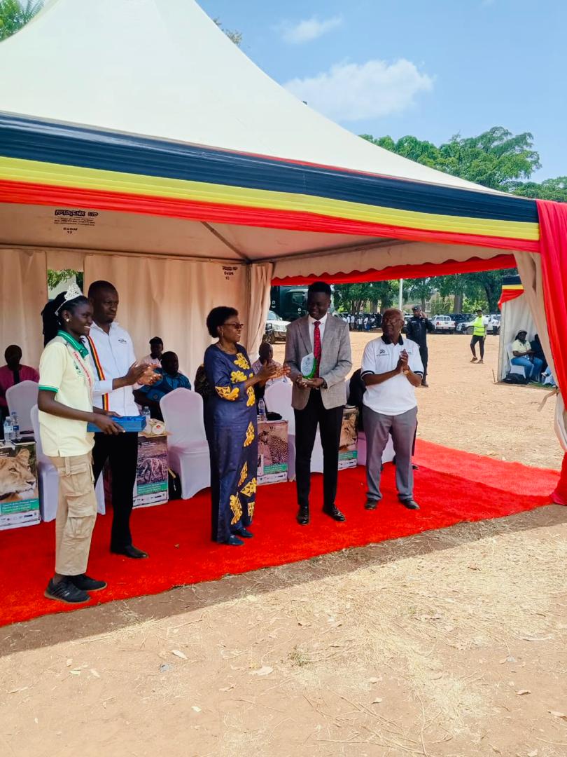
Receiving the Wildlife Digital Innovations award from the Ugandan Government on World Wildlife Day, March 2025 – Credit: Michael Jurua
Uganda has an incredibly young population (with potentially over three quarters under the age of 35) and, fresh from delivering the keynote address at the 35th Celebration of Roots & Shoots in Uganda, Michael again focuses on youth:
“Looking back, I think the thread connecting everything — the research, the fieldwork, the community monitoring networks, the international recognition — runs directly back to that early experience of being trusted with real responsibility as a child. Roots & Shoots didn’t just teach me about the environment. It taught me who I could be in relation to it. Conservation wasn’t something that happened elsewhere, it happened here, in Uganda. And we had a role in it.”
Follow Michael Jurua on Linkedin
For information on key scientific roles in conservation check out the Conservation Careers Answers to Key Questions.
Author Profile | Claire Tyrrell
 Claire is a wildlife enthusiast and keen amateur conservationist, and has volunteered long-term in wildlife rescue and rehabilitation centres across Africa and Asia – largely working with primates. Having worked in the TEFL industry for quite some years (teaching, writing and editing) she now works for the National Trust in visitor welcome and volunteers when possible for the Hampshire Wildlife Trust.
Connect with Claire on LinkedIn.