

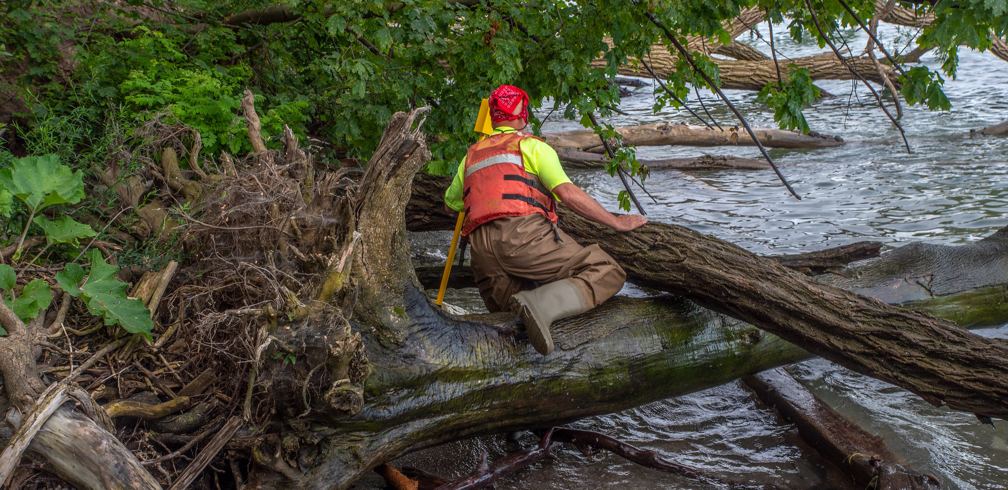
GIS Analysts are a type of Conservation Scientist, one of the Key Conservation Roles.
Within the context of conservation, Conservation Scientists are relatively well paid. Here’s how pay for most Conservation Scientist roles compares with other conservation roles. Keep in mind that this is a general guide, and that pay can vary with employer type, location and job level.

*Pay for senior-level Organisational Manager roles can reach a 5.
**Pay for veterinary sub roles can reach a 4.
Salaries can vary depending on the employer type, with business and government usually offering the highest salaries, followed by the academic and charity sectors.
To research salaries for GIS Analyst roles in your region, we recommend searching the Economic Research Institute’s Compensation Hub. To research salaries for Conservation Scientists in your region, we recommend searching our Conservation Job Archive as a Conservation Careers Academy member.
GIS Analysts are a type of Conservation Scientist, one of the Key Conservation Roles. Typical early-career Conservation Scientist roles that focus on working with data usually require the following:

Conservation Scientist sub roles, such as GIS Analysts, often have specific requirements. Try searching our Job Archive as a Conservation Careers Academy member to learn more about the requirements for GIS Analysts.
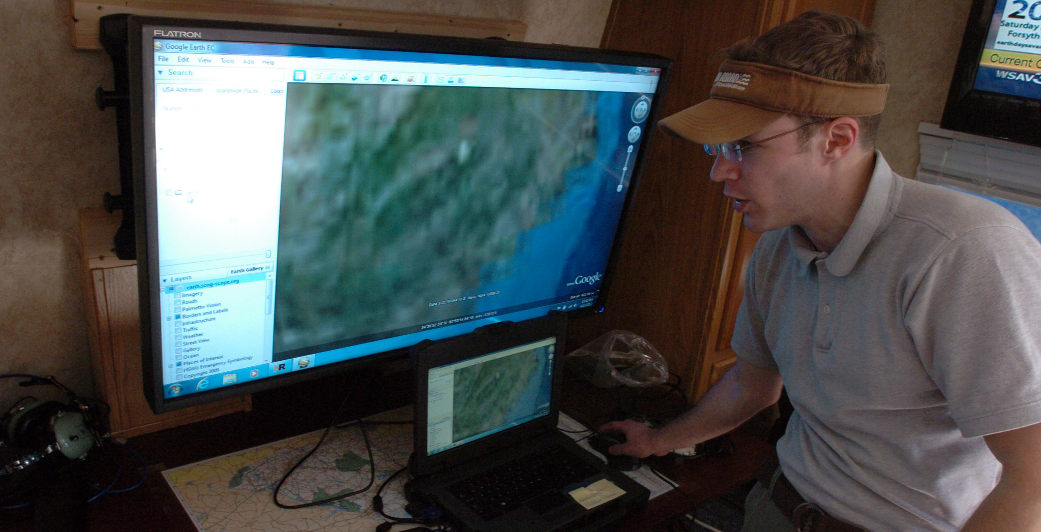
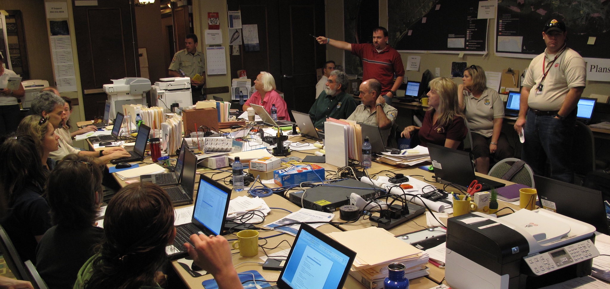
 Common GIS Analyst duties include:
Data collection & management
Gather spatial data from satellites, GPS, drones or field surveys.
Manage geodatabases, clean data and document metadata.
Spatial analysis & modelling
Analyse species distributions, habitat suitability and land use change.
Model threats like deforestation or climate change impacts.
Conduct terrain, corridor and buffer zone analysis.
Mapping & visualisation
Produce clear, compelling maps for reports, stakeholders and public outreach.
Build interactive web maps or story maps for conservation communication.
 Team & technical support
Provide spatial insights to ecologists, planners and NGOs.
Contribute to tools like Marxan or InVEST.
Support and train staff in GIS tools and mobile data collection apps.
Automation & tool development
Automate workflows with Python, R or ModelBuilder.
Create custom tools or dashboards for monitoring and decision-making.
Monitoring & evaluation
Track habitat change, species trends and restoration outcomes.
Support conservation planning and measure protected area effectiveness.
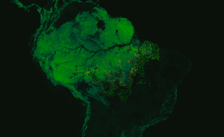
Top image: Forest cover and deforestation in Amazonia. Credit: Mapbox via Flickr.
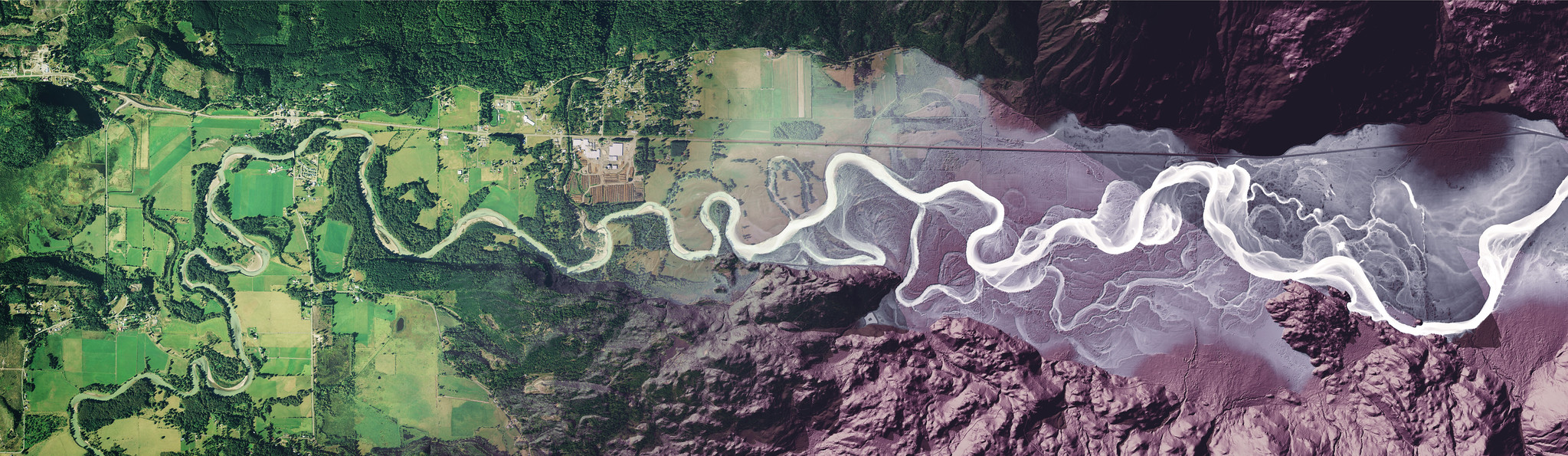
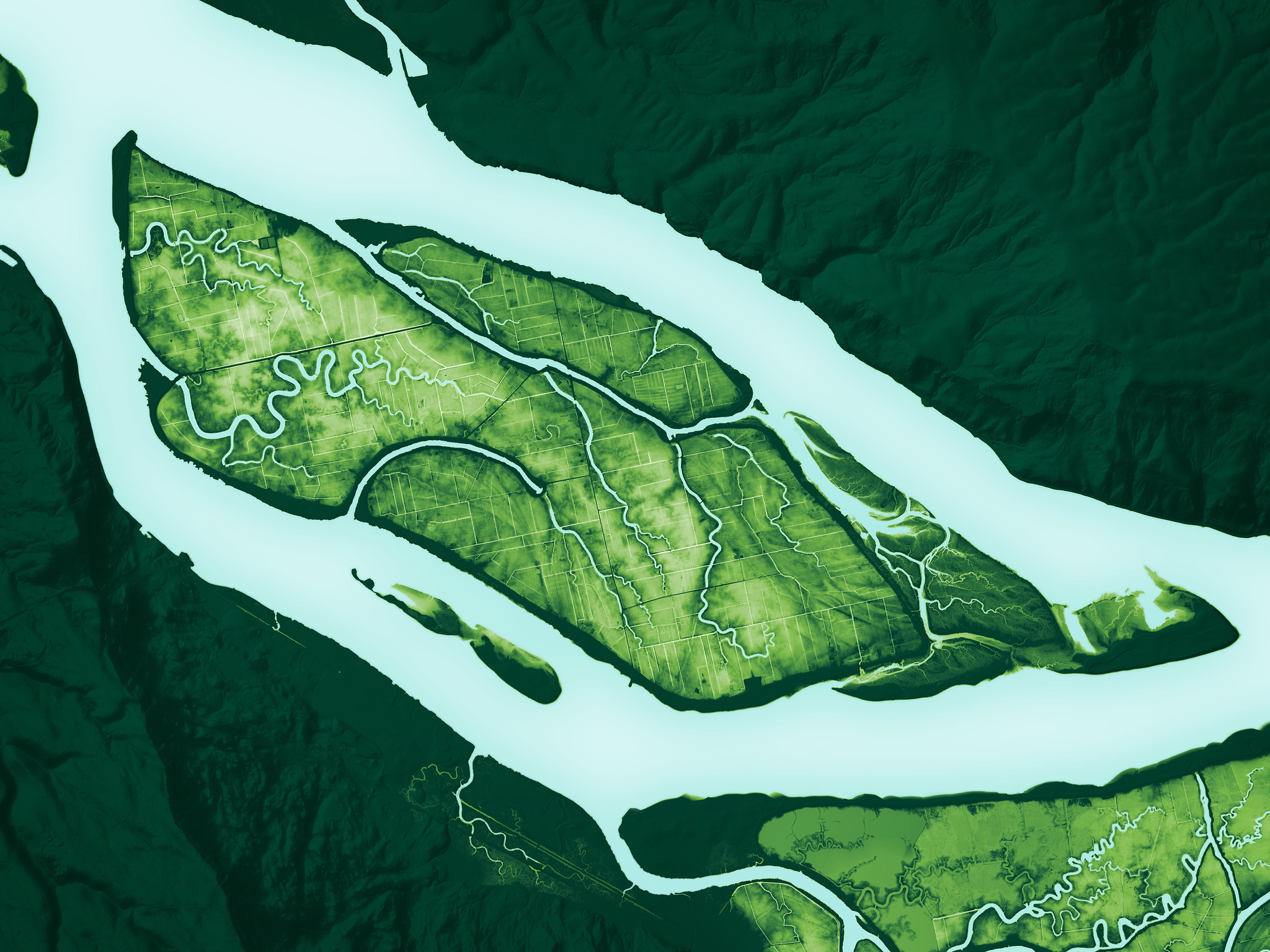
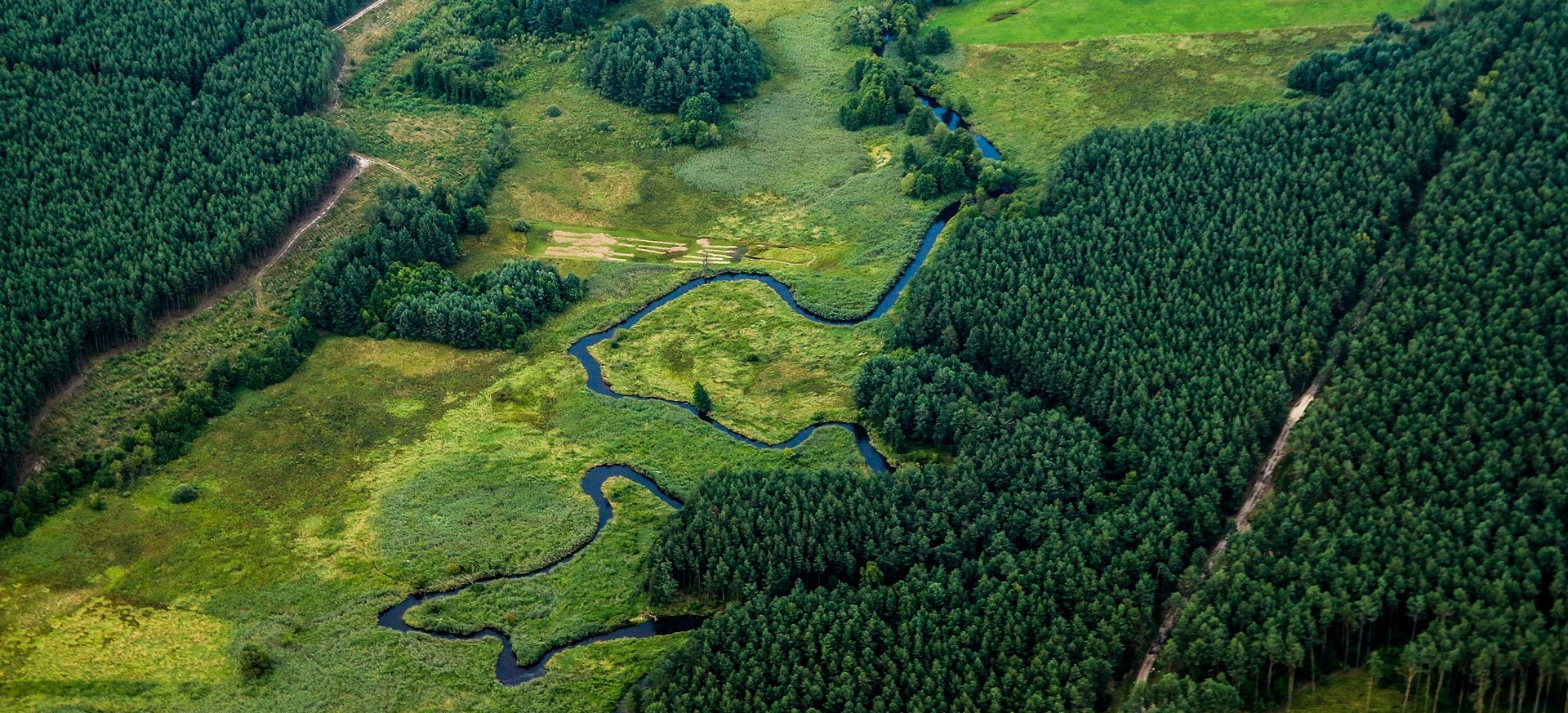
Bottom image: And image of islands in the lower Columbia River, USA, derived using Lidar – a remote sensing method used to examine the surface of the Earth. Credit: Daniel E. Coe. Image from the Washington Geological Survey (Washington State DNR) via Flickr.


There are many societies and professional organisations for GIS Analysts worldwide. Here are just a few to get you started:
GIS Analyst societies globally:
 Society for Conservation GIS (SCGIS). SCGIS supports conservation GIS practitioners worldwide with training, grants, a global community and an annual international conference.
 The Open Geospatial Consortium (OGC). An international consortium developing open standards for geospatial content and services, including tools used in conservation GIS.
 Geospatial Information & Technology Association (GITA). GITA connects professionals using geospatial technologies in infrastructure and environmental services, with applications relevant to conservation.
GIS Analyst societies in the United Kingdom:
- Royal Geographical Society (RGS).
 The RGS promotes geography and supports professionals using GIS for environmental and conservation applications, particularly in the UK.
 - British Cartographic Society (BCS)
 . BCS brings together mapmakers and GIS professionals, with regular conferences, workshops and awards that highlight conservation mapping.
  Association for Geographic Information (AGI). AGI represents the UK geospatial community, including those in conservation, with networking events, advocacy and professional development resources.
GIS Analyst societies in the United States:
 Ecological Society of America – GIS Section. A section of ESA dedicated to advancing GIS in ecological research and conservation, offering symposia, networking and resources for GIS analysts in the USA.
 URISA – Urban and Regional Information Systems Association. A US-based professional body for geospatial professionals, offering certifications, workshops, and events, with applications in environmental and land management.
GIS Analyst societies in Africa, Europe, South America, the Pacific and globally:
 Africa GeoPortal Community (powered by Esri). A collaborative platform connecting GIS users across Africa with a focus on conservation, development, and humanitarian applications.
- Sout
 h African Geomatics Institute (SAGI). SAGI is a national professional body for geomatics and GIS professionals, supporting applications in land, environmental, and conservation planning.
  Environmental Information Systems Africa (EIS-Africa). A pan-African network focused on environmental and geospatial information systems for sustainable development, conservation, and natural resource management.
 EUROGI – European Umbrella Organisation for Geographic Information. EUROGI connects national and regional geographic information associations across Europe and promotes the use of GIS for sustainable development and environmental management.
 Association Française pour l’information Géographique (AFIGEO). France’s main GIS association, AFIGEO supports professionals through events, working groups and partnerships, including applications in biodiversity and spatial planning.
 Deutsche Gesellschaft für Kartographie (DGfK). Germany’s Cartographic Society brings together GIS and mapping professionals, including those in environmental protection, with conferences and educational initiatives.
 Pan-American Institute of Geography and History (PAIGH). A regional organisation that promotes cooperation in cartography, geography and GIS across Latin America and the Caribbean, including environmental and heritage mapping.
 Sociedad Chilena de Ciencias Geográficas (SOCHIGEO). Supports Chilean geographers and GIS professionals, with projects and research related to conservation, natural hazards and land use.
 Instituto Brasileiro de Geografia e Estatística (IBGE). While primarily a national statistics agency, IBGE is a major hub for GIS and remote sensing professionals in Brazil, many of whom work on environmental and conservation issues.
 Survey and Spatial New Zealand (S+SNZ). New Zealand’s national body for GIS and geospatial professionals, supporting conservation-related mapping through its Spatial Special Interest Group.
 Pacific GIS & Remote Sensing Council (PGRSC). A regional network supporting GIS and remote sensing professionals across the Pacific Islands, focusing on climate, biodiversity, and coastal ecosystem management.
 Australian & New Zealand Map Society (ANZMapS). Supports mapping and GIS professionals with a strong focus on environmental history, conservation, and spatial heritage.

 Andrew Cottam is the Head of Geospatial at Restor, a free online platform for the restoration movement that puts major scientific datasets at the fingertips of conservationists. Andrew explains how technology is helping in the battle to restore life on earth, and how you can get involved in your lives or your careers. Listen here.


To help illustrate GIS Analyst roles, here are several job descriptions that represent (real) entry level GIS Analyst jobs. Pay particular attention to the selection criteria (specifications) to learn more about what conservation employers are looking for when they hire GIS Analysts.
 GIS Professional – Field Research | Panthera | Bogotá, Colombia (2025)
Panthera, founded in 2006, is devoted exclusively to the conservation of wild cats and their ecosystems. Utilizing the expertise of the world’s premier cat biologists, Panthera develops and implements global conservation strategies for the most imperiled large cats – tigers, lions, jaguars, snow leopards, cheetahs, pumas and leopards. Representing the most comprehensive effort of its kind, Panthera works in partnership with local and international NGOs, scientific institutions, local communities and governments around the globe. For more on Panthera, visit www.panthera.org.
Job Purpose
The GIS professional is responsible for the field data collection, data processing, equipment and deployment preparation, GIS production work, and other tasks related. A large component of the position will be collaboration with Panthera biologists, communications and development staff in the development and implementation of innovative monitoring and analysis methods.
Duties and Responsibilities
- Provide graphic representations of spatial data (i.e. maps, figures and charts) for scientific publications, grants proposals, popular media, and online content.
- Organize and complement the geographical information available at Panthera Colombia with official public information sources.
- Compile and/or create accurate spatial covariate data (including Google Earth Engine) for use in analysis by Panthera research scientists and collaborating agencies
- Work in collaboration with academic partners, including overseeing student volunteers in production of high-quality operational maps used for field research
- Provide trainings and advice for Panthera’s field personal on the use of GIS data and methods
- Field varied, and sometimes urgent, requests for data, spatial analyses, and maps from Panthera personal
- Ensure the implementation of Panthera´s global guidelines for data processing and GIS management
- Support the camera trap analysis and processing of the information requested in projects
- Support on fundraising from its expertise
Qualifications
Education and degree
- Bachelor’s degree in Geography, Environmental Science, or related field
- Desirable Master’s in Geography, GIS, Environmental Science, or related field
Experience
Experience required:
- Minimum 2 years of experience working in the field
- Experience with GIS software
- Experience developing and maintaining spatial databases, including data collected from handheld GPS units
- Knowledge of remote sensing theory and methods
- Experience with cartographic design using GIS software and Adobe Create Cloud
- Experience creating maps and other informational graphics to disseminate conservation data, programs, and initiatives to the public
- Prior experience in NGOs desired
Skills & abilities
- Strong computer skills
- Exceptional interpersonal and communications skills and a passion for interacting with people
- Ability to communicate effectively with varying audiences
- Availability to spend extended periods of time in field conditions
- Experience with conservation
- Attention to detail. Strong time management and organizational skills
- Adaptable and able to work in a multicultural team
- Excellent Spanish language skills
Working Conditions and Physical Requirements:
- Good English language skills
- Position based in Bogotá, Colombia
- Availability to travel around Colombia
About Panthera
Founded in 2006, Panthera is devoted to the conservation of the world’s 40 species of wild cats and the vast ecosystems they inhabit. Our team of biologists, data scientists, law enforcement experts and wild cat advocates studies and protects the seven species of big cats: cheetahs, jaguars, leopards, lions, pumas, snow leopards and tigers. Panthera also creates targeted conservation strategies for the world’s most threatened and overlooked small cats.
With our supporters around the world, we inform the public about the plight of wild cats, help local communities live in harmony with wild cats, protect wild cats and their prey from poaching, fight the illegal wildlife trade and safeguard the precious landscapes wild cats need to survive.
Data & Technology Technician | Panthera | Remote, Tanzania (2025)
Panthera is the only organization in the world that is devoted exclusively to the conservation of the world’s 40 wild cat species and their ecosystems. Utilizing the expertise of the world’s premier cat biologists, Panthera develops and implements global strategies for the most imperiled species. Representing the most comprehensive effort of its kind, Panthera partners with local and international NGOs, scientific institutions, local communities, governments around the globe, and citizens who want to help ensure a future for wild cats. Panthera Corporation consists of Panthera Corporation- USA and several foreign legal entities and foreign branch offices. For more on Panthera, visit www.panthera.org.
Panthera registered in Tanzania as an international NGO in 2025. The organisation’s activities focus on the western Tanzania conservation landscape, where we will be providing financial, logistical, and technical protection support to local partners, and supporting wildlife monitoring activities.
Position title: Data & Technology Technician
Reports to: Data Manager: Southern & East Africa
Geographic Scope: Tanzania
Duty Station: Tabora, Tanzania
Overview
The Data & Technology Technician will support the Tanzania Wildlife Authority (TAWA) and other relevant partners in the implementation, management, and use of SMART (Spatial Monitoring and Reporting Tool) for law enforcement monitoring in western Tanzania. This includes providing support for data collection protocols, data quality control and cleaning, managing data flows, generating regular reports, and troubleshooting technical issues.
The role will also assist TAWA in integrating patrol, ecological, and incident data through platforms such as EarthRanger (or similar), and in the use of other relevant conservation technologies, such as satellite communicators and trackers (e.g. Garmin InReaches), GPS devices, and GIS tools. The Technicians will help ensure the effective deployment and maintenance of these tools, while also building capacity and providing continued support among TAWA staff and partners in their effective use.
The position is based in Tabora, with frequent travel to TAWA offices in the region, and occasional travels to Protected Areas and potentially to Dar es Salaam, Arusha, and Morogoro. Occasional international travel, as required, may be expected. Candidates should have a background in conservation, ecology, or a related field, along with a strong interest in data management and applied technologies in conservation contexts.
Responsibilities & duties
- Support TAWA and other partners in the implementation and management of SMART, including data collection, cleaning, verification, and standardisation of SMART patrol data and other relevant datasets (e.g. human-wildlife conflict, ecological monitoring).
- Maintain and update data management protocols and Standard Operating Procedures (SOPs) for SMART use, and support the testing and rollout of new SMART features or updates as required.
- Assist TAWA and partners in ensuring data quality by supporting adherence to protocols, managing data flows from field to database, and maintaining organised, well-structured data catalogues.
- Work closely with TAWA SMART focal points to ensure accurate and timely data entry from field patrols, including by attending operational planning and debrief meetings where SMART outputs are presented.
- Support TAWA in the generation of SMART reports and maps that highlight patrol effort, threat detection, and other key indicators, and in the interpretation and visualisation of SMART data to support site-level decision-making.
- Provide input for donor reporting, particularly regarding outputs related to law enforcement and conservation outcomes.
- Support TAWA and partners in the deployment, maintenance, and troubleshooting of additional conservation technologies, including EarthRanger (or similar) and control room applications, GPS units, satellite communicators, and other relevant tools, including by developing SOPs, working with TAWA to ensure compliance, and providing feedback to improve system use.
- Provide follow-up support, assistance, and mentoring for partners on all the above technologies as required, including through the provision of relevant training sessions.
Assist in developing training materials, SOPs, and user manuals for field and office-based staff. - Assist with procurement, budgeting, and inventory management processes for technology-related equipment, software, and data systems.
- Participate in broader Panthera activities as required, including wildlife monitoring support, workshops, and assistance with field operations.
- Maintain accurate monthly financial records and report expenditures to Panthera staff in Tanzania and internationally.
Qualifications, experience and personality traits
- Bachelor’s degree in wildlife management, conservation biology, ecology, natural resources management, or a related field (required); postgraduate qualification (preferred).
- Experience working with SMART, EarthRanger, or similar conservation data management systems (preferred)
- Demonstrated ability to manage, clean, analyse, and interpret large datasets.
- Experience producing summary reports, dashboards, or maps from field-collected data.
- High level of computer literacy, including strong Excel skills; familiarity with GIS software is an advantage.
Strong interest and aptitude in technology, with willingness to learn new tools and platforms. - Ability to train others in the use of data management tools and protocols.
- Experience operating in the field within Protected Areas, including the ability to travel and work in remote locations for extended periods.
- Excellent interpersonal and communication skills, including the demonstrated ability to work collaboratively with government partners.
- Valid driver’s license.
- Meticulous attention to detail and commitment to data accuracy and security.
- Tanzanian national proficient in both Kiswahili and English (spoken and written).
 Biodiversity Analyst | Washington D.C., USA | IUCN (2025)
Unit: Centre for Science and Knowledge
Organisation: International Union for Conservation of Nature (IUCN)
Location: North America Regional Office, Washington D.C., United States of America
Reporting to: Head of Conservation Science and Technology
Work percentage: 100%
Grade: P1
Type of contract: Fixed-term (12 months with possibility of renewal)
BACKGROUND
IUCN’s Science Team, within the Science & Data Centre, represents IUCN’s expertise on conservation science with an emphasis on standards and metrics to assess the status of and risk to biodiversity, and reduce and responses to reverse this risk. It generates new and insightful analysis that advances conservation perspectives and raises IUCN’s credibility and profile, while at the same time, provides the necessary support to other teams for the consistent integration of scientifically robust baselines and analysis across the IUCN programme portfolio. The Science Team is globally decentralised with staff in San Jose (Costa Rica), Cambridge (United Kingdom), Gland (Switzerland), and Washington DC (USA).
A particular focus of this position will be working with the Species Threat Abatement and Restoration (STAR) metric, which was developed by IUCN and designed to support science-based target setting for species conservation (Mair et al. Nature Ecology and Evolution, 2021). STAR quantifies the reduction in global species extinction risk that could be achieved in any given area of interest (AOI) through two approaches: threat abatement and habitat restoration . The STAR metric enables conservation actors to measure their contributions within frameworks that link threat abatement and habitat restoration activities (Targets 1-8 in the Kunming Montreal Global Biodiversity Framework) to species conservation outcomes (Goal A of this framework). Estimated STAR scores provide useful information on the species and threats likely present within an area. However, to effectively sett and measure progress towards targets in an AOI, these estimates must be confirmed within the area. This validation process produces a calibrated STAR score against which conservation progress can be measured. Currently, methods are being developed to deploy remotely sensed data to improve this calibration process. These methods aim to confirm both species presence and threats occurrence, while also assessing threat intensity within specific AOI.
JOB DESCRIPTION
Major responsibilities
The Biodiversity Analyst will support the execution of the portfolio of projects through the Science Team. A key responsibility will be analyzing and applying biodiversity data that adheres to IUCN standards across all projects. The Analyst will collaborate closely with IUCN Commissions and partner organisations with peer conservation science-related institutions and networks, including IUCN Member institutions and external partners such as the Global Environment Facility and NASA. The role will also involve contributing to scientific publications into the peer reviewed literature, either into independent scientific journals or as IUCN publications, as well as presentations in scientific and policy-related conferences and other fora.
The Biodiversity Analyst position requires expertise in advanced spatial analysis of biodiversity data. The ideal candidate will have strong experience in data wrangling, spatial analyses and statistical modelling in R, including proficiency in integrating remotely sensed data with in situ species data on the ground. The Biodiversity Analyst will play a significant role in extending the STAR metric as well as deploying it through analyses and in collaboration with end-users (for example in Mesoamerican protected areas). The Biodiversity Analyst will serve a substantial role in supporting end-user (businesses, governments, civil society institutions, Indigenous groups) in calibrating site-specific STAR analyses through R-based spatial analysis working with the Integrated Biodiversity Assessment Tool (ibat-alliance.org), to develop tailored biodiversity assessments. Finally, the Biodiversity Analyst will support project design, management and reporting to Science Team project portfolio, including liaising with the finance team for budget management.
Specific duties
- Design and execute complex spatial analyses of biodiversity data in R. For example:
a. Working with Area of Habitat and threat data to incorporate new taxonomic groups, eg. Trees into the STAR metric.
b. Drawing on remotely sensed data to update habitat cover and analyze trends across regions such as biodiversity hotspots - Undertake a substantial role in supporting end-users’ efforts to calibrate STAR in order to guide conservation actions in their particular areas of interest through spatial analysis (eg in R), interactions with IUCN tools and systems, interactions with end-users and other stakeholders, and coordination with experts (eg. IUCN SSC Commission Members).
- Fulfil project management responsibilities for day-to-day coordination, substantive tracking and reporting on relevant aspects of the Science Team project portfolio projects such as Earth Observations and Biodiversity Hotspots.
- Serve as focal point for collaborations with remote sensing experts developing methods for assessing threats to species (drawing from the IUCN threats classification) that can be measured using remotely sensed data.
- Support the implementation of other relevant Science Team projects, in particular through the development of the metrics and methods for science-based targets for biodiversity, including GIS analyses in R, coordination, meeting and event organization and preparation, publications, and liaising with the broader network of stakeholders and contributing to novel analysis.
- Support the application of the data and knowledge products mobilised against IUCN standards (including but not limited to the IUCN Red List of Threatened Species and Red List of Ecosystems, the World Database of Key Biodiversity Areas, and the World Database of Protected Areas, IUCN Green List, World Heritage) as appropriate in all projects, including, contributing to novel analyses (e.g., of agriculture as a driver of extinction risk).
- Perform other duties as may be assigned from time to time.
The above job description contains the main duties and responsibilities for this position. However, in an organisation such as IUCN, staff members are expected to show flexibility in their approach to work and be willing to undertake other tasks that are reasonably allocated to them, but which are not part of their regular job description. Where any task becomes a regular part of an employee’s responsibilities, the job description will be changed in consultation with the employee and the Human Resources Management Group.
REQUIREMENTS
- PhD in conservation-related scientific field required
- Strong quantitative and analytical skills including expertise and facility performing geospatial analysis in R, data wrangling, and statistical modelling required
- Experience working with spatial biodiversity data required.
- Experience working with IUCN Red List of Threatened Species very useful
- Experience working with and analysing remotely sensed data required
- Excellent people skills, organization, and attention to detail required
- Excellent knowledge of the conservation-related scientific literature required
- Ability to work independently required
- Ability to work effectively with multidisciplinary teams and adapt to diverse cultural contexts required
- Fluency in English required. Fluency in Spanish or French very useful
- Experience collaborating with stakeholders at local, national, and international levels very useful
- Willingness to undertake some travel associated with the position required
- Experience of field conservation in the Global South useful
- Passion for conservation essential
SALARY
The gross annual salary for this position is between USD 81’950 and USD 102’438. While this is an indicative amount effective as of the current date, changes may occur as per IUCN’s compensation practices without prior notice. The same applies to other organisations hosted by IUCN.
About IUCN
IUCN is a membership Union uniquely composed of both government and civil society organisations. It provides public, private and non-governmental organisations with the knowledge and tools that enable human progress, economic development and nature conservation to take place together.
Created in 1948, IUCN is now the world’s largest and most diverse environmental network, harnessing the knowledge, resources and reach of more than 1,400 Member organisations and around 16,000 experts. It is a leading provider of conservation data, assessments and analysis. Its broad membership enables IUCN to fill the role of incubator and trusted repository of best practices, tools and international standards.
IUCN provides a neutral space in which diverse stakeholders including governments, NGOs, scientists, businesses, local communities, indigenous peoples organisations and others can work together to forge and implement solutions to environmental challenges and achieve sustainable development.
Working with many partners and supporters, IUCN implements a large and diverse portfolio of conservation projects worldwide. Combining the latest science with the traditional knowledge of local communities, these projects work to reverse habitat loss, restore ecosystems and improve people’s well-being.
Spatial Data Scientist | Wallingford, UK | UK Centre for Ecology & Hydrology (2025)
Are you an enthusiastic environmental scientist with excellent spatial data skills and an interest in creating national data and digital tools to support nature recovery and sustainable land management? If so, we have an exciting opportunity for you to work with leading scientists and contribute to world-class research at UKCEH Wallingford.
Join our dynamic team to help turn cutting-edge environmental research into high quality data and practical digital tools to support decision making for nature-based finance, policy-makers and land.
You will work closely with our earth observation scientists to develop a variety of innovative data products from classified high resolution satellite imagery – including national maps targeting opportunities for Biodiversity Net Gain, and novel mapping of above-ground biomass and urban wildlife habitat and green space. You’ll also contribute to national nature recovery efforts by mapping habitat restoration potential across Great Britain, using GIS and spatial datasets to guide local and strategic planning. Finally, you will play an important role in developing the Farm Health Check— an interactive tool providing farmers with accurate, impartial data on their natural capital and environmental risks.
Your work will involve the integration and analysis of spatial data, extracting summary metrics, and creating intuitive data visualisations to support on the ground decision-making. You will be involved in stakeholder consultation and engagement to enable the co-design of our data products and tools.
You will also have opportunities to publish data papers in peer-reviewed journals and publish data products through our Environmental Data Information Centre. We offer extensive training to support your technical and professional growth within a research environment.
Your main responsibilities will include:
- Apply advanced GIS tools to spatial datasets to derive key information and innovative metrics
- Create efficient, reproducible workflows to integrate and analyse complex spatial datasets
- Develop innovative ways to visualise data in ways that are intuitive for stakeholders
- Contribute to the development of decision support tools (Farm Health Check) and data products (Habitat Potential Maps)
- Work effectively with project teams that include internal and external collaborators
- Communicate research to a range of audiences, including project partners and stakeholders
For the role of Spatial Data Scientist, we’re looking for somebody who has:
- Advanced skills in GIS and geospatial data analysis
- High level of expertise in handling and analysing spatial data in R
- Ability to implement interpretable and reusable code to ensure the longevity, maintainability, and adaptability of code across projects
- Familiarity with collaborative tools like GitHub
- Creation of interactive spatial data visualisations (e.g., Leaflet)
- Experience in producing dynamic HTML/PDF reports using tools such as R Markdown or Quarto
- A methodical approach and attention to detail, ensuring the delivery of accurate and reliable information to stakeholders.
- Familiarity with UK-extent spatial datasets with a range of sources, formats and resolutions
- Good knowledge of key issues in UK sustainable land use, agriculture and nature conservation
- A working knowledge of UK habitat classification systems (e.g. Priority Habitats, UKHAB, NVC etc)
- Demonstrate a commitment to promote and adhere to UKCEH values of Excellence, Integrity and Teamwork.
Qualifications and experience:
- A postgraduate qualification and/or equivalent experience in a relevant field (e.g. application of geospatial data analysis to environmental research challenges)
- Experience of handling a wide range of spatial data types and formats in GIS environments
- Experience of creating stakeholder-facing visualisations and insights from environmental data
You’ll be joining a leading independent, not-for-profit research institute that’s committed to recruiting talented people like you, progressing your career and giving you the support you need to thrive at UKCEH.
Our science makes a real difference, enabling people and the environment to prosper, and enriching society. We are the custodians of a wealth of environmental data, collected by UKCEH and its predecessors over the course of more than 60 years.
Working for UKCEH is rewarding
We appreciate the continuous dedication and contributions of our staff, which is why we provide a comprehensive benefits package that includes financial incentives and wellbeing-oriented perks, such as:
- 27 days annual leave (rising to 29 days after 5 years’ service) plus 3 days for Christmas closure
- 10% employer pension contribution
- Flexible and hybrid working arrangements (role dependant)
- Peer reward and recognition scheme
- Dental insurance, gym/fitness discounts, retail discount portal
- Enhanced maternity and paternity leave
- 24-hour, 365-day support with physical, mental, social, health or financial issues and much more…
 Conservation Scientist
Conservation scientists answer key questions to tackle biodiversity loss. They focus on science and research, from field and/or desk-based research, to GIS, mapping and data analysis. Explore.
How to become an ecologist
![]() Ecologists study the relationships between living things (including humans!) and the environment around them. Examples include: Assistant Ecologist, Ecologist, Consultant Ecologist. Explore.
Ecologists study the relationships between living things (including humans!) and the environment around them. Examples include: Assistant Ecologist, Ecologist, Consultant Ecologist. Explore.